☽
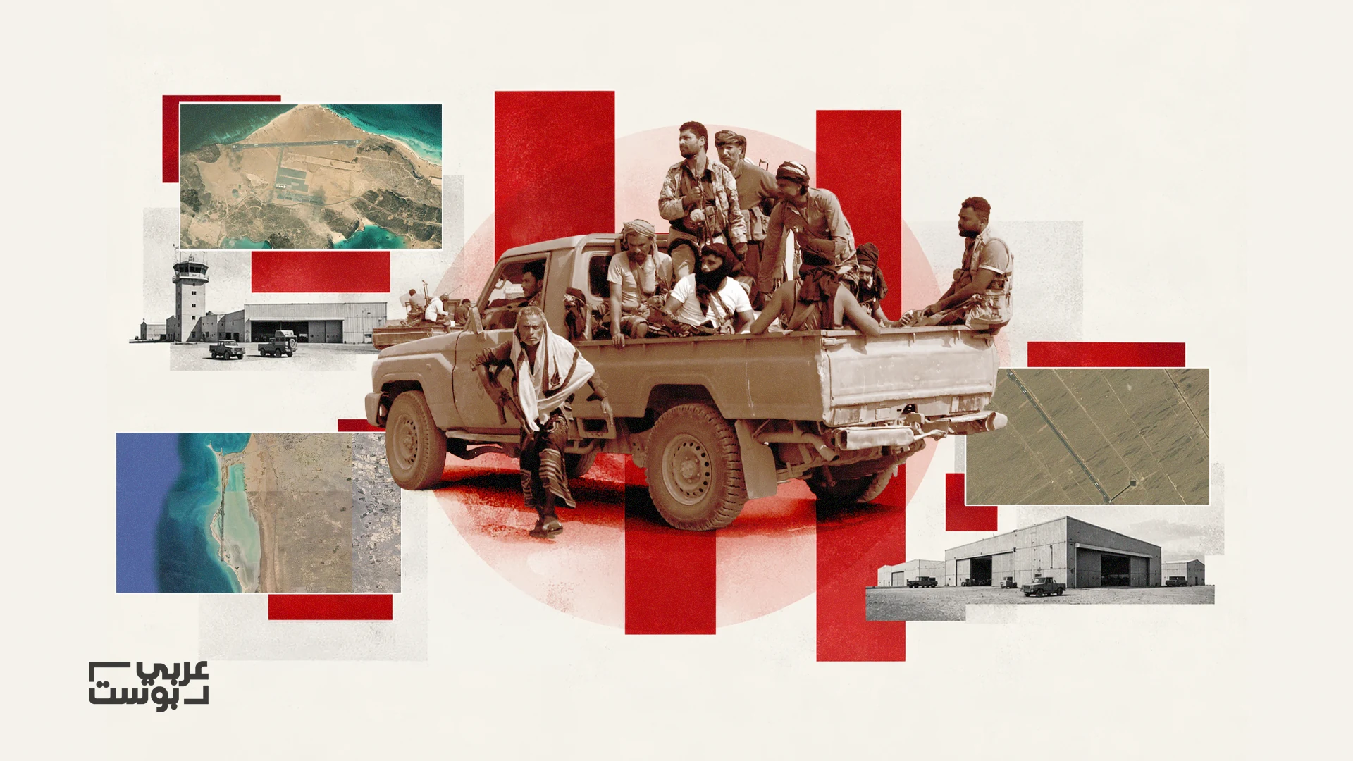
Bases, Airports and Ports “Arabi Post” traces the network of UAE-linked facilities seized by the Houthis in western Yemen
Englishالعربية
Englishالعربية
“Arabi Post” has traced the most prominent military sites and facilities seized by the Houthis during their offensive on Yemen’s western coast, which began in early September 2026 and remains ongoing as of today. These are sites that the UAE or forces allied with it played a role in establishing, developing, or operating, or in recapturing from the Houthis during the years of war.
These facilities include five military camps, two airports, a port, and air and naval facilities on two islands, stretching from Al-Khawkhah, Mokha, and “Dhu Bab” along the coast to the islands of Zuqar and Mayyun in the southern Red Sea near the Bab al-Mandab Strait.
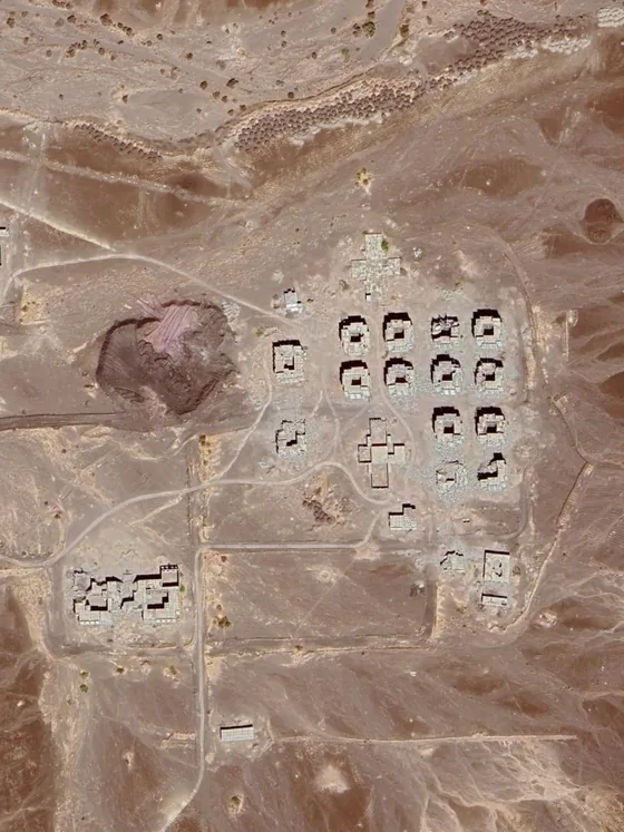
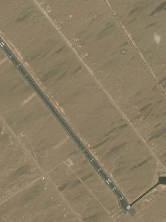
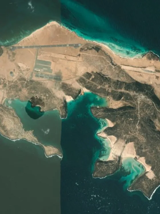
The investigation relied on satellite imagery, which we used to compare the sites across different periods in order to determine which facilities existed before the UAE intervened as part of the Saudi-led coalition and which were built or expanded during that intervention.
The changes visible in the imagery were then cross-referenced with announcements concerning construction, funding, and handovers, as well as reports documenting the Emirati military presence and the activities of forces allied with the UAE. The shifts in control during the September 2026 offensive were tracked through video footage and combat-tracking maps.
Before early September 2026, the Houthis controlled the city of Hodeidah and its port, as well as most of the northern and central parts of the governorate.
Anti-Houthi government forces, comprising several formations, controlled the coastal strip extending south from Hodeidah toward Al-Khawkhah, Mokha, and Dhu Bab, all the way to Bab al-Mandab, in addition to strategic islands in the Red Sea.
The Houthi offensive altered this map, as they advanced through the governorates of Hodeidah and Taiz and extended their offensive to several islands.
To track the facilities that came under their control, the investigation focused on two areas: the first along the coast, encompassing ports, airports, and military camps in Mokha and its surroundings, followed by Dhu Bab and Al-Khawkhah; and the second covering the islands of the southern Red Sea and the Bab al-Mandab area, foremost among them Mayyun and Zuqar.
On September 10, 2026, the Houthis seized the Red Sea coastal city of Mokha, in western Taiz Governorate, after advancing through military positions east of the city that had formed part of the defense network protecting Yemen’s western coast.
In recent years, Mokha had served as the headquarters of the “National Resistance” forces led by Tariq Saleh and as the hub of a network of military camps and positions that anti-Houthi forces had recaptured during the war. These forces received Emirati support before their backing shifted to Saudi Arabia in early 2026, following the collapse of the UAE-Saudi understanding in Yemen at the end of 2025.
The UAE’s military presence in Mokha began after government forces and the Popular Resistance recaptured the city from the Houthis in early 2017. Emirati forces took part in the operation to seize the city on the ground and provided fire support, as UAE media reported at the time.
In the years that followed, the UAE contributed to the construction and development of military and civilian facilities in and around Mokha, including a new airport, while military camps that predated the war became part of the network of sites used by UAE-backed forces along the coast.
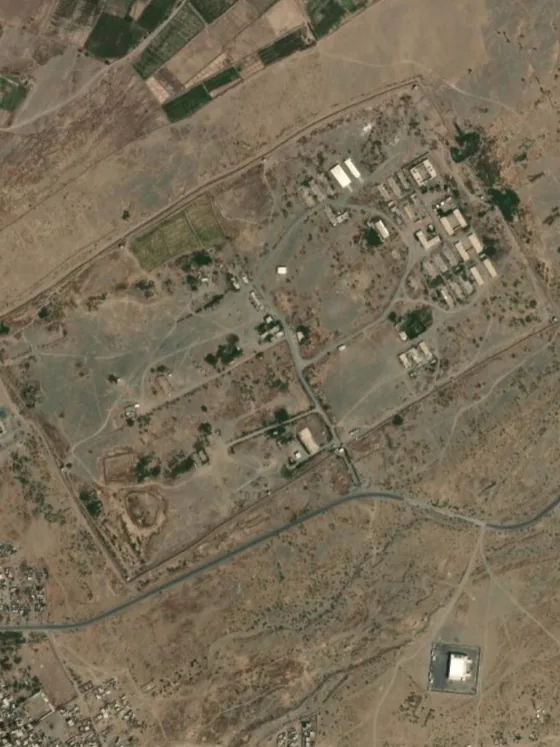
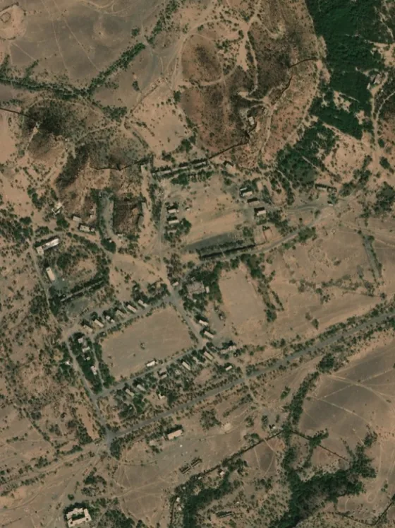
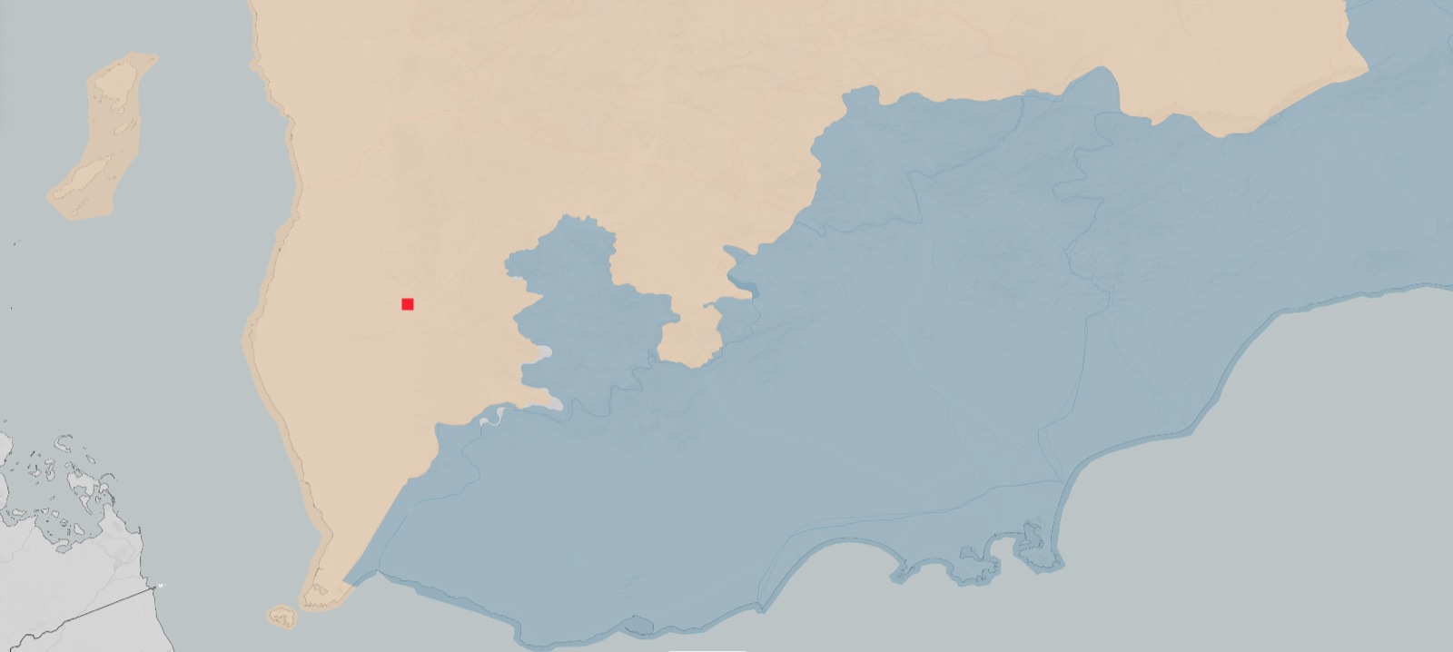
A day before Mokha fell, on September 9, 2026, the Houthis seized Khalid bin Al-Walid Camp, located in Mawza District in western Taiz Governorate, near the Mokha junction. The camp is one of the largest military sites in the area, covering approximately 12 square kilometers.
The camp was not built by the UAE during the war; it existed before the coalition’s intervention. Government forces and the Popular Resistance took full control of it in July 2017 with air support from the coalition.
After the camp was captured, Emirati forces participated in consolidating control over it and fortifying it. The camp was later associated with operations by the National Resistance forces led by Tariq Saleh.
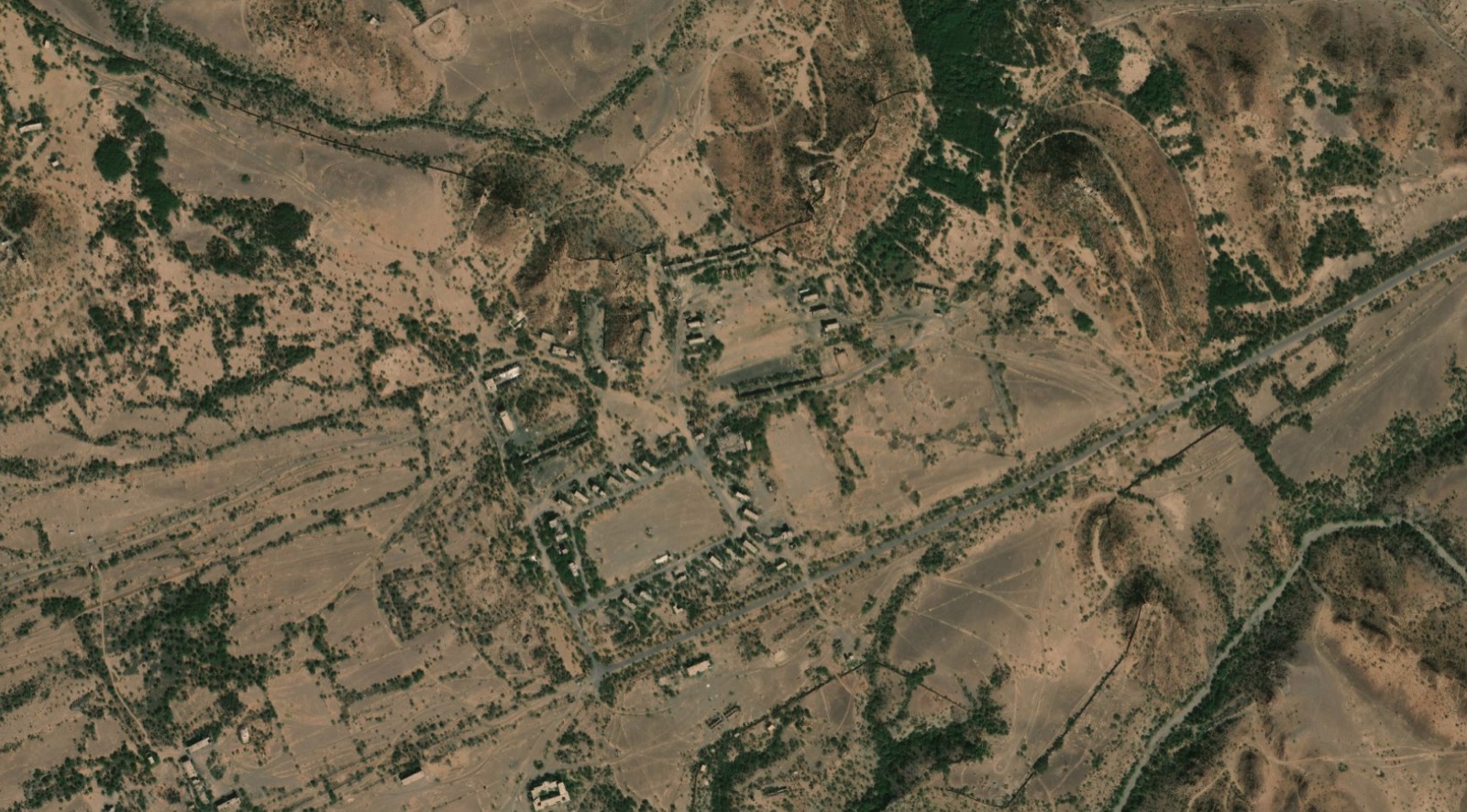 Camp perimeter — about 12 km²
 Tap to enlarge
A review of the camp’s geographic location shows that its significance stems not only from its size and facilities, but also from its position. It lies near the Mokha junction, where roads branch off toward the city and the coast to the west, Taiz to the east, Hodeidah to the north, and Al-Wazi’iyah and the southern areas.
This indicates that the camp occupies a forward position along the roads leading to Mokha, allowing forces stationed there to secure their movements and supply lines between the coast and Yemen’s interior.
The importance of this geography was evident in the sequence of the Houthi offensive itself in September 2026. The camp fell one day before the Houthis reached Mokha, and Houthi-aligned media linked its capture to the severing of supply lines to anti-Houthi forces and the facilitation of the Houthi advance toward the coast.
After seizing the camp, the Houthis continued their advance toward Mokha, which contained other facilities built or developed during the years it was controlled by UAE-backed forces, foremost among them the airport.
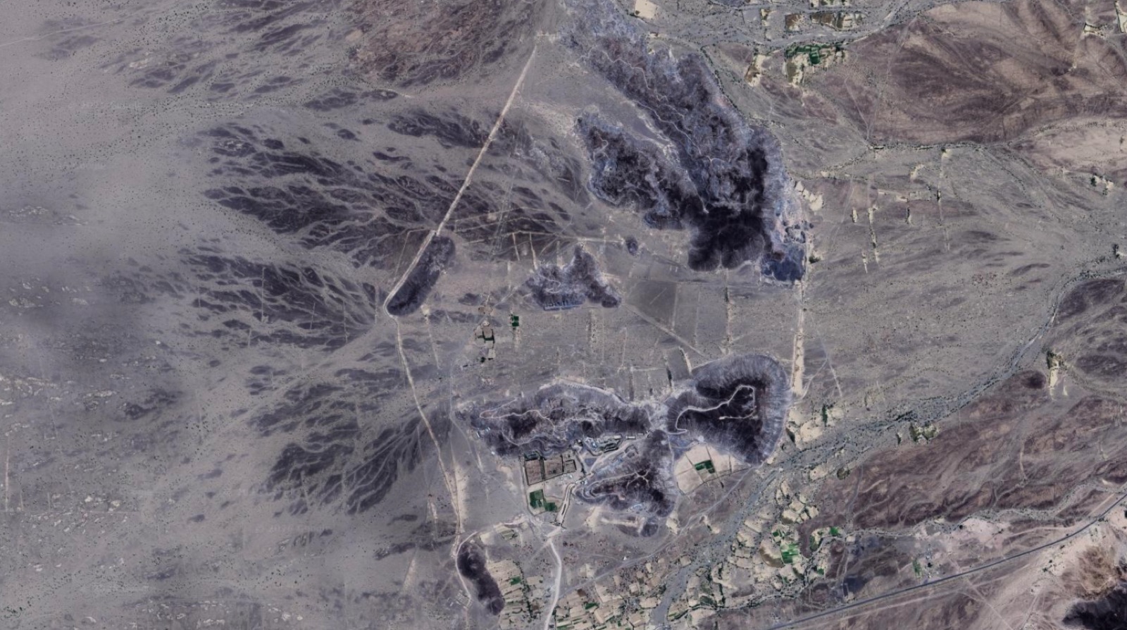
Khalid bin Al-Walid Camp was not the only position lost by anti-Houthi forces around Mokha. The following day, September 10, 2026, the Houthis seized Jabal al-Nar Camp east of the city.
 Jabal al-Nar
Tap to enlarge
Jabal al-Nar
Tap to enlarge
 Tap to enlarge
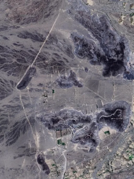
Government forces had recaptured the mountain during the 2017 battles for the western coast. On February 23 of that year, the Emirati newspaper Al Bayan reported that forces participating in Operation “Golden Spear” had taken control of it, describing the UAE Armed Forces as being at the forefront of those forces.
Jabal al-Nar subsequently became the headquarters for the command of military forces on the western coast under Tariq Saleh, who was backed by the UAE. The site’s significance therefore extended beyond the military camp itself to its role in directing military operations around Mokha.
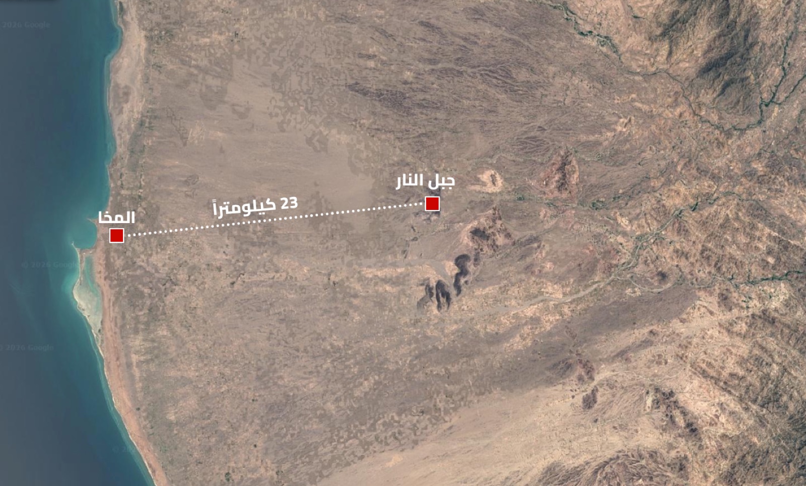
The mountain’s location reinforced this function. It lies east of the city, approximately 23 kilometers from its airport and port, near the road network connecting Khalid bin Al-Walid Camp with Mokha and extending south toward Dhu Bab and Bab al-Mandab.
Yemeni reports state that Emirati forces remained stationed at Jabal al-Nar until January 2026, when they withdrew amid tensions with Saudi Arabia. However, these reports did not provide conclusive evidence to substantiate the claim.
With the fall of Jabal al-Nar, anti-Houthi forces lost a site associated with the command of their operations east of Mokha, on the same day that control of the city, its airport, and its port changed hands.
Unlike Khalid bin Al-Walid Camp, which existed before the war, Mokha Airport was built during the years in which anti-Houthi forces controlled the city, with UAE support and funding. The project was overseen by the “National Resistance” forces led by Tariq Saleh.
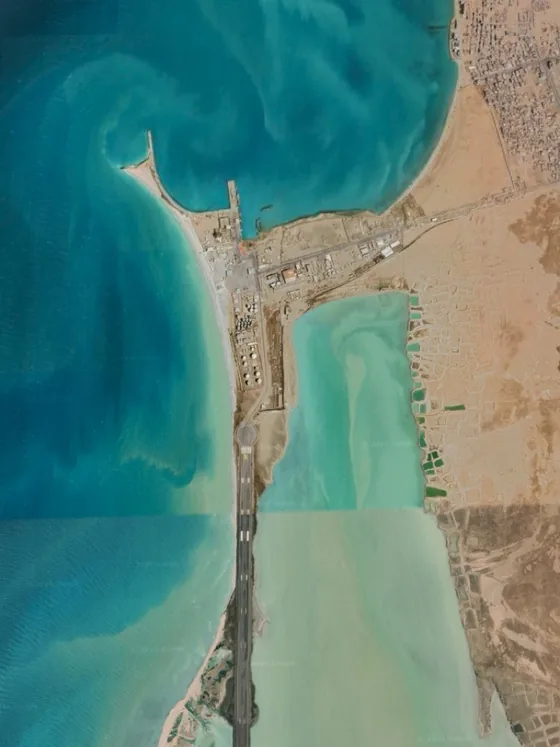
Yemeni reports differ over when construction of the airport began, with some dating it to 2019 and others to 2021. “Arabi Post” compared satellite imagery of the site from the two periods, and the images showed that the clearest signs of construction and development appeared after April 2021. Work on the runway and other airport facilities continued over the following years.
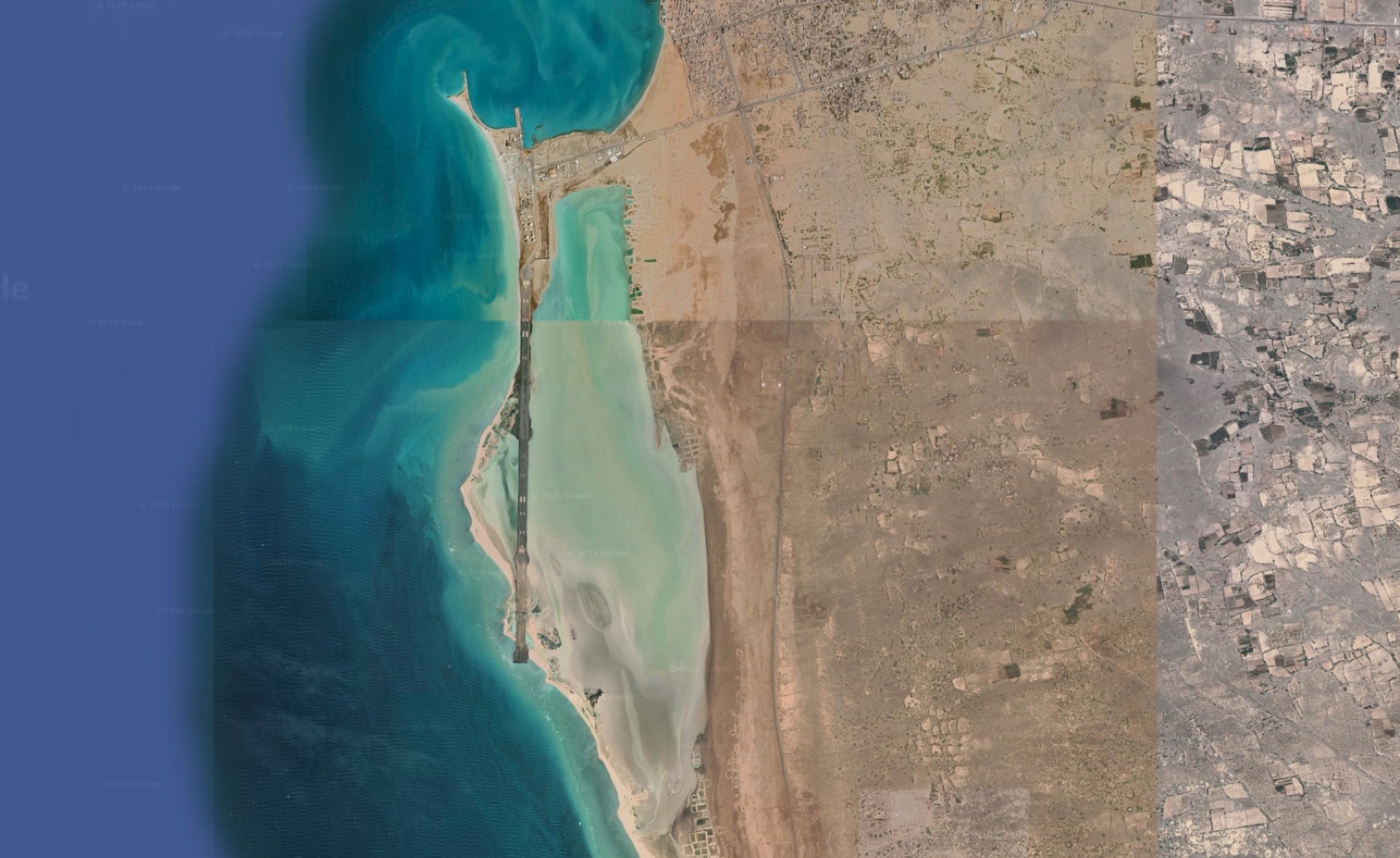
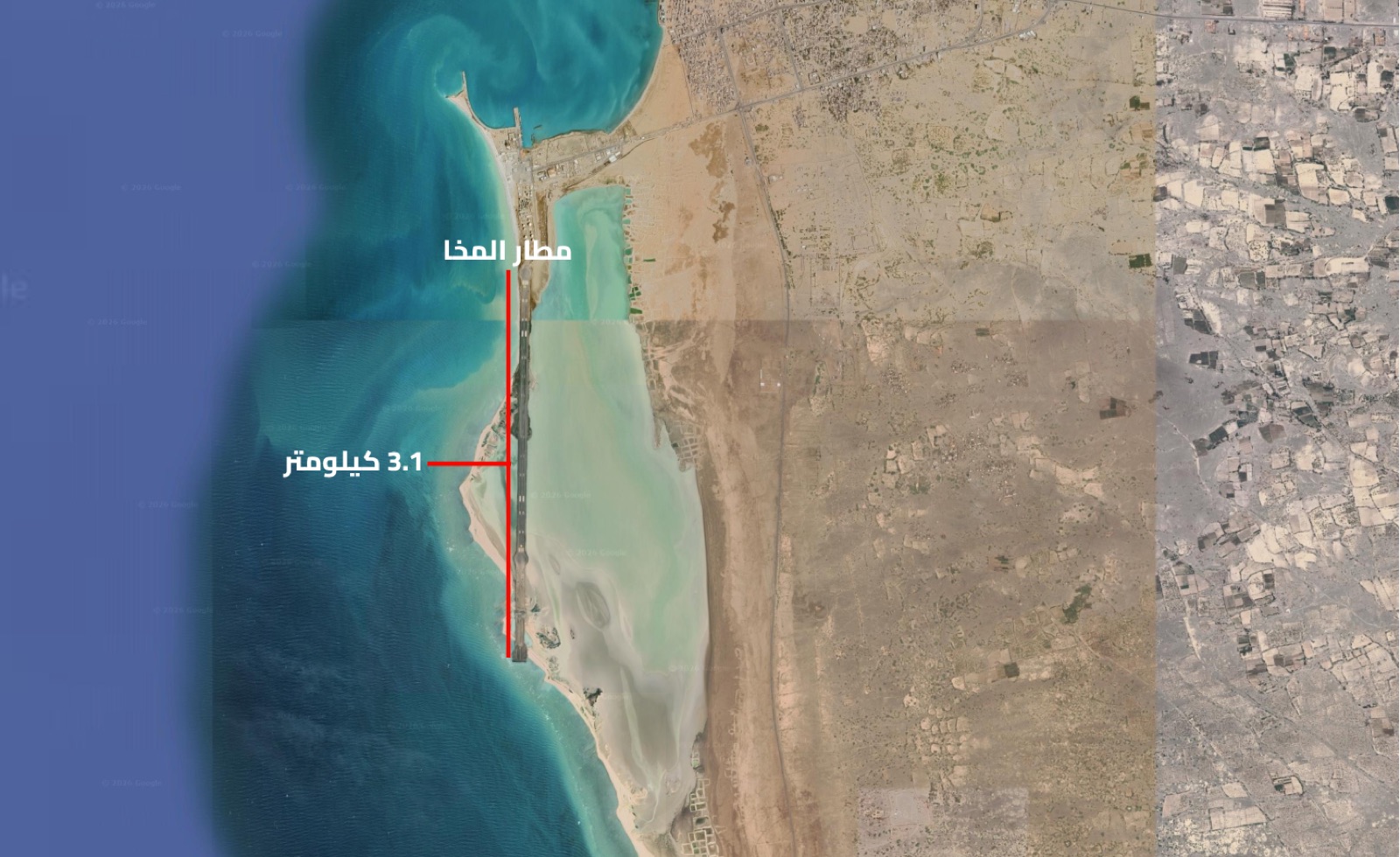
The runway is approximately 3.1 kilometers long, and the airport includes a control tower, a passenger terminal, and other operational facilities. It provided Tariq Saleh’s forces with aviation infrastructure close to their areas of deployment along the western coast.
With the fall of Mokha on September 10, 2026, the airport came under Houthi control, and Tariq Saleh’s forces lost an air access point close to their positions along the coast.
The following day, Houthi-run media reported that Saudi Arabia had carried out an airstrike on the airport. However, according to the Associated Press, there were no reports of damage to its facilities or casualties.
The latest satellite image reviewed by “Arabi Post,” captured on September 18, 2026, also shows the runway and airport facilities with no visible signs of damage.
Latest image reviewed by Arabi Post 18 September 2026
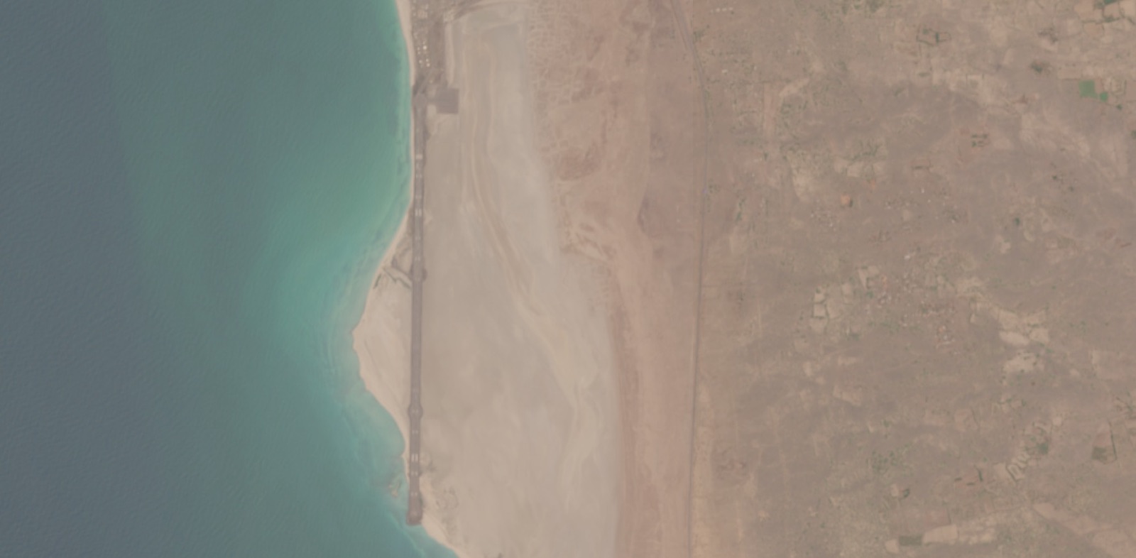 Tap to enlarge
Control of the airport gives the Houthis an aviation site on the western coast, close to the Bab al-Mandab Strait, as well as infrastructure that could theoretically be used to receive support by air, similar to the flight Reuters revealed in July 2026.
Near Mokha Airport lies the city’s port on the Red Sea. Unlike the airport, which was built during the war, the port predates the UAE intervention by decades, having undergone extensive infrastructure development in the late 1970s.
Anti-Houthi forces took control of Mokha in early 2017, and in 2018, the UAE Ministry of Foreign Affairs announced work to rehabilitate and develop the city’s port.
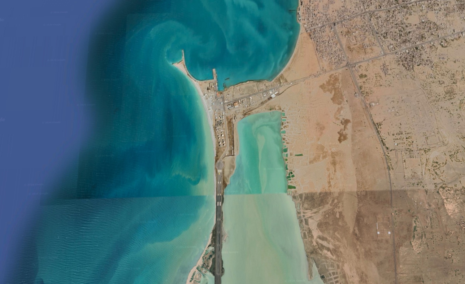 Tap to enlarge
The port lies close to Bab al-Mandab. It provides whoever controls it with direct maritime access to the western areas of Taiz, as well as the ability to monitor maritime traffic in the Red Sea.
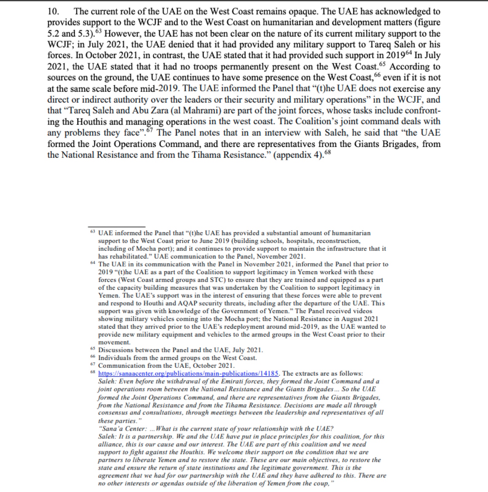
A UN document shows how Mokha Port’s civilian function overlapped with its military role. In the final report of the UN Panel of Experts on Yemen, issued in January 2022, the UAE presented its role on the western coast as humanitarian assistance: it told the Panel in November 2021 that, prior to June 2019, it had provided assistance that included building schools and hospitals and carrying out reconstruction projects, including the rehabilitation of Mokha Port, and that it continued to support the maintenance of infrastructure it had rehabilitated.
In the same report, the Panel states that it received video footage showing military vehicles entering the port, and cites the “National Resistance” as saying in August 2021 that the vehicles had arrived before the redeployment of Emirati forces around mid-2019, because the UAE wanted to provide armed groups on the western coast with new military equipment and vehicles before its departure.
In the same submission, the UAE acknowledged that, before 2019, as part of the coalition, it had trained and equipped these forces as part of capacity-building measures, with the knowledge of the Yemeni government.
 Tap to enlarge
After the Houthis seized Mokha on September 10, 2026, the port also came under their control, leaving Tariq Saleh’s forces without a maritime access point close to their areas of deployment, in the same city where they also lost the airport.
South of the city of Mokha, the Dhu Bab area stretches along the western coast of Taiz Governorate toward the Bab al-Mandab Strait. In this area, “Arabi Post” tracked two military sites that came under Houthi control during the September 2026 offensive: Bani al-Hakam Airport and Al-Omari Camp.
Control of Dhu Bab changed hands several times during the war. In October 2015, Yemeni government forces backed by the coalition seized the area, with a government spokesman saying at the time that Emirati and Saudi forces had played a key role in supporting the operation. The Houthis recaptured it in February 2016, before government forces regained control in January 2017 during Operation “Golden Spear.”
From then on, Dhu Bab remained under the control of anti-Houthi forces. A new airport was built near Bani al-Hakam, while older military sites remained in use, including Al-Omari Camp, until both sites fell to the Houthis as they advanced south of Mokha.
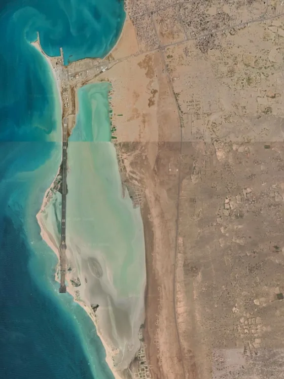
About 12 kilometers from Dhu Bab and roughly 6 kilometers from the coast, Bani al-Hakam Airport, also known as “Bab al-Mandab Airport,” was built during the final years in which UAE-backed forces controlled the area.
Satellite imagery compiled by “Arabi Post” shows that construction activity began to appear at the site in July 2023, eventually resulting in a runway approximately 3.2 kilometers long, along with associated facilities.
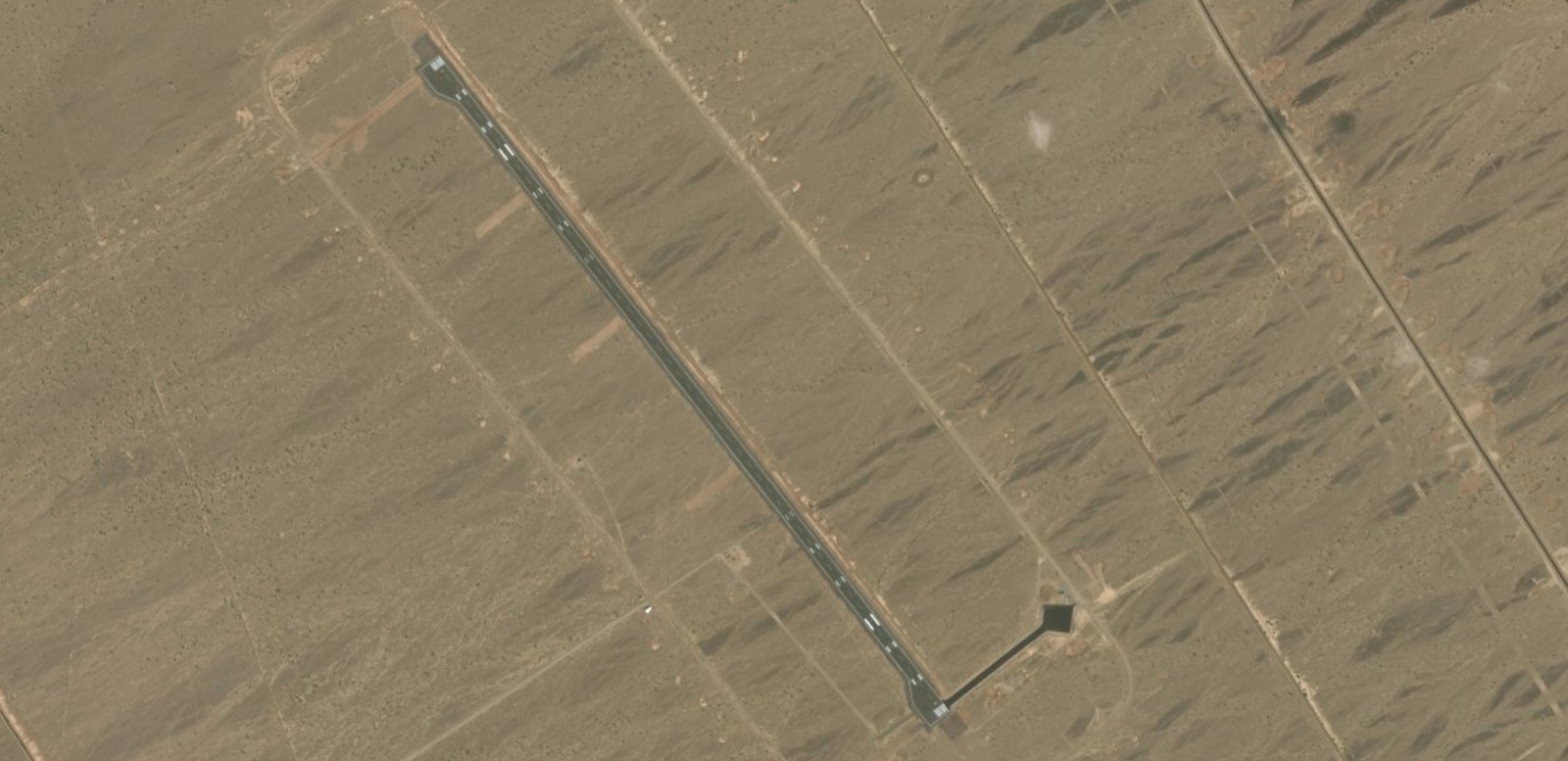 Runway length about 3.2 km
Tap to enlarge
Runway length about 3.2 km
Tap to enlarge
A runway roughly 3.2 kilometers long with associated facilities.
The UAE played a role in constructing the airport, according to media affiliated with the “National Resistance” forces led by Tariq Saleh. The reports stated that the forces’ “Engineering Department” carried out the Bab al-Mandab Airport project with Emirati support.
The airport’s significance stems from its location and the length of its runway. An aviation facility south of Mokha Airport, close to the coast and the road leading to Bab al-Mandab, provides forces capable of operating it with an additional hub for transporting personnel and supplies and supporting their deployment along the southern part of the western coast.
With the airport coming under Houthi control in September 2026, anti-Houthi forces lost another aviation site near Bab al-Mandab, after having already lost Mokha Airport to the north.
Alongside Bani al-Hakam Airport, “Arabi Post” tracked the change in control of Al-Omari Camp during the Houthi advance through Dhu Bab. Unlike the airport, which was built in recent years, Al-Omari is a military camp that predates the war. Historically associated with the 17th Armored Brigade, the area surrounding it became the scene of repeated battles between the Houthis and anti-Houthi forces.
The camp lies south of Mokha, in an area connecting the coastal road leading to Bab al-Mandab with the military positions scattered around it. This location gives the camp strategic importance for forces deployed in the area.
Control of the camp changed hands several times. In early 2017, coalition-backed Yemeni government forces recaptured it and drove out the Houthis. Fighting around the camp resumed in 2018, when Emirati forces took part in seizing it alongside the Giants Brigades and resistance forces, according to Emirati media.
The Houthis regained control of Al-Omari Camp on September 10, 2026. With the camp falling to the Houthis, anti-Houthi forces lost another military position in Dhu Bab, at the same time as they lost Bani al-Hakam Airport.
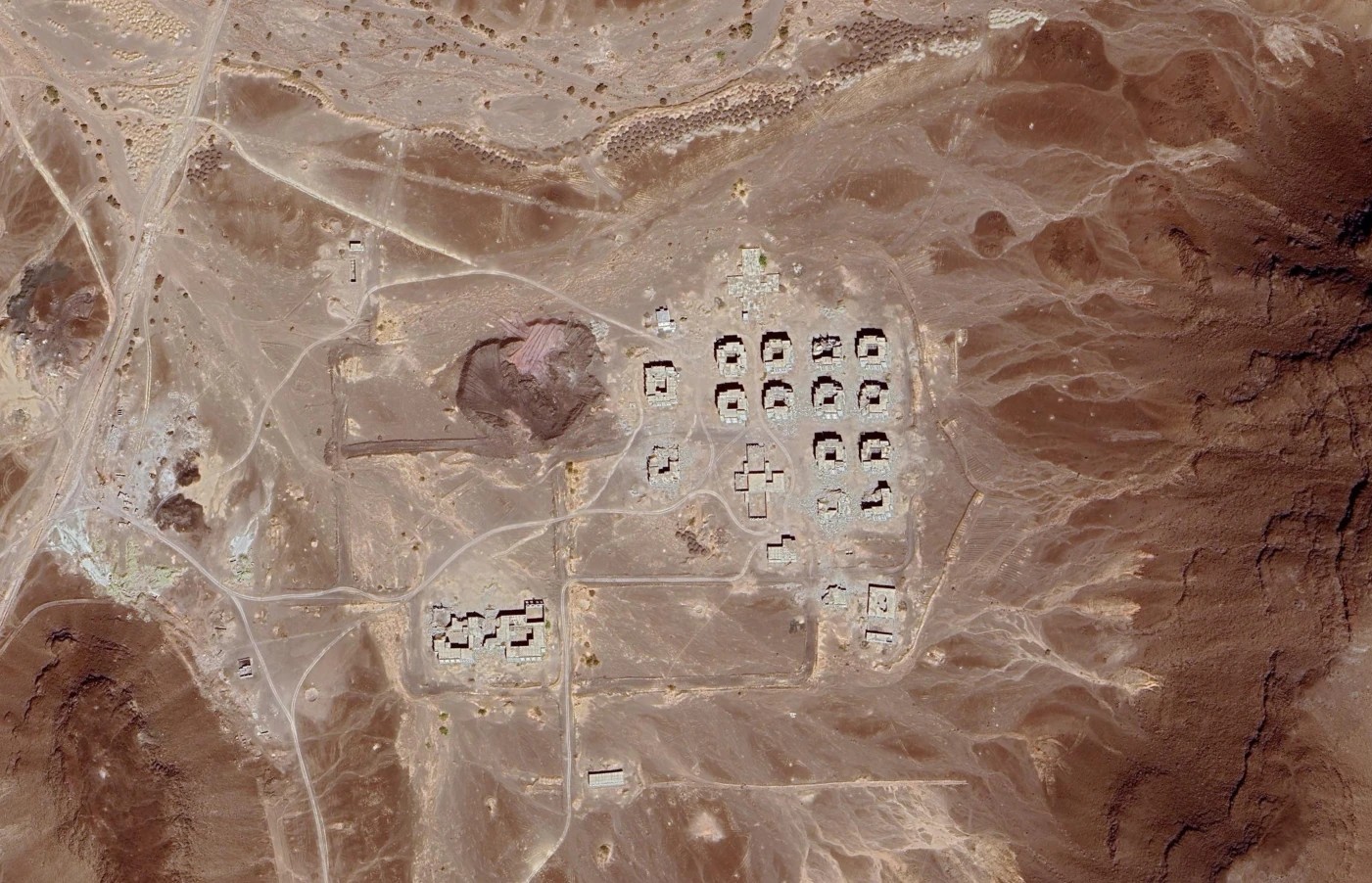 Tap to enlarge
Al-Omari Camp
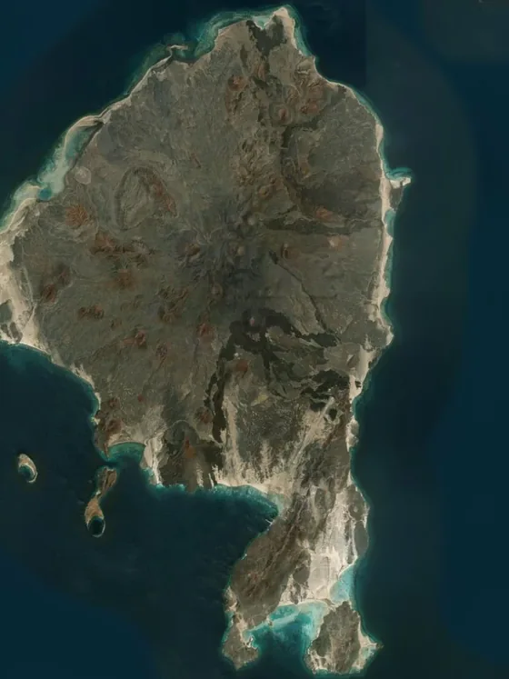
After seizing military and aviation sites in Dhu Bab, the Houthis extended their advance to Mayyun Island, also known as “Perim Island,” located within the Bab al-Mandab Strait. They seized the island on September 11, 2026, after years during which Yemeni, Emirati, and Saudi forces had successively been deployed there.
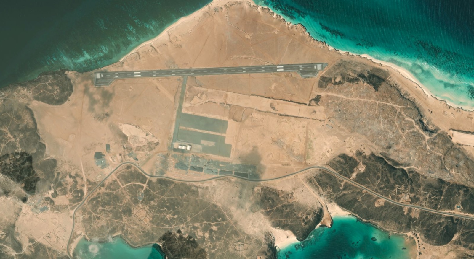
Mayyun lies within the Bab al-Mandab Strait, dividing it into two maritime channels: a narrow eastern channel along the Yemeni coast and a wider western channel used by international shipping. During the war, two separate attempts were made to build an airstrip on the island, with satellite imagery revealing the different stages of both projects.
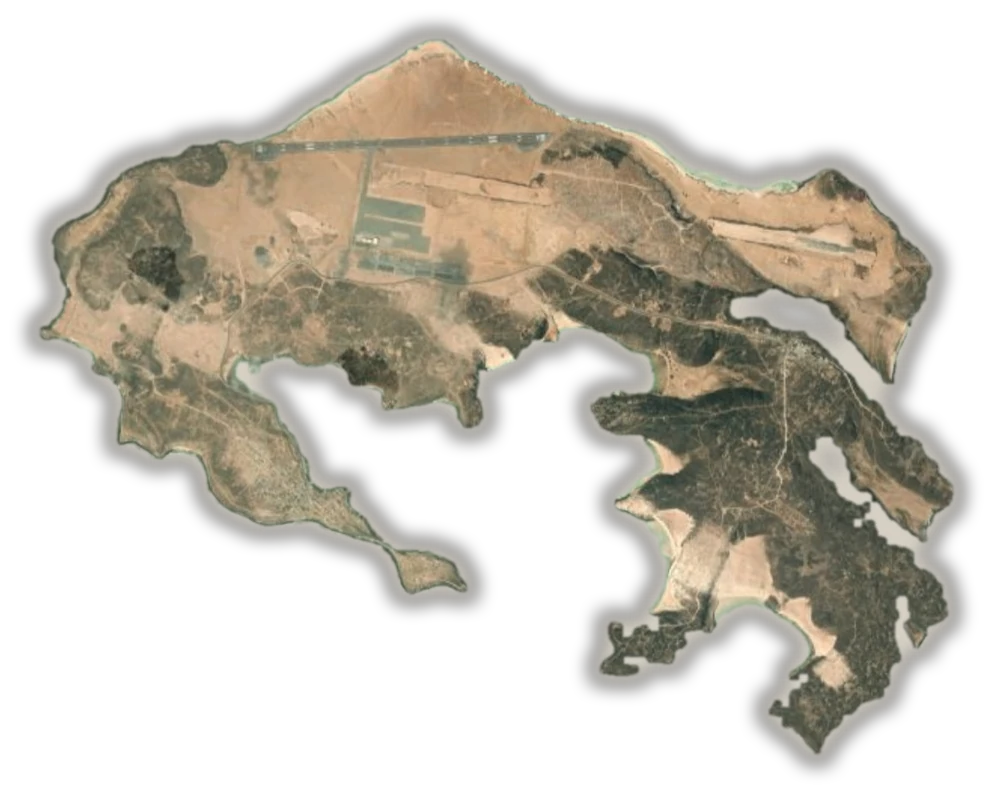
1The first airstrip northeast of the island, begun in late 2016 and halted before completion
2The second airstrip northwest of the island, about 1.85 km with three hangars — 2021 imagery
The island divides the strait into two channels: a narrow eastern channel along the Yemeni coast and a wider western channel used by international shipping.
The island is cut out at the shoreline from a satellite image, and the sea is removed so that only what stands on land is visible.
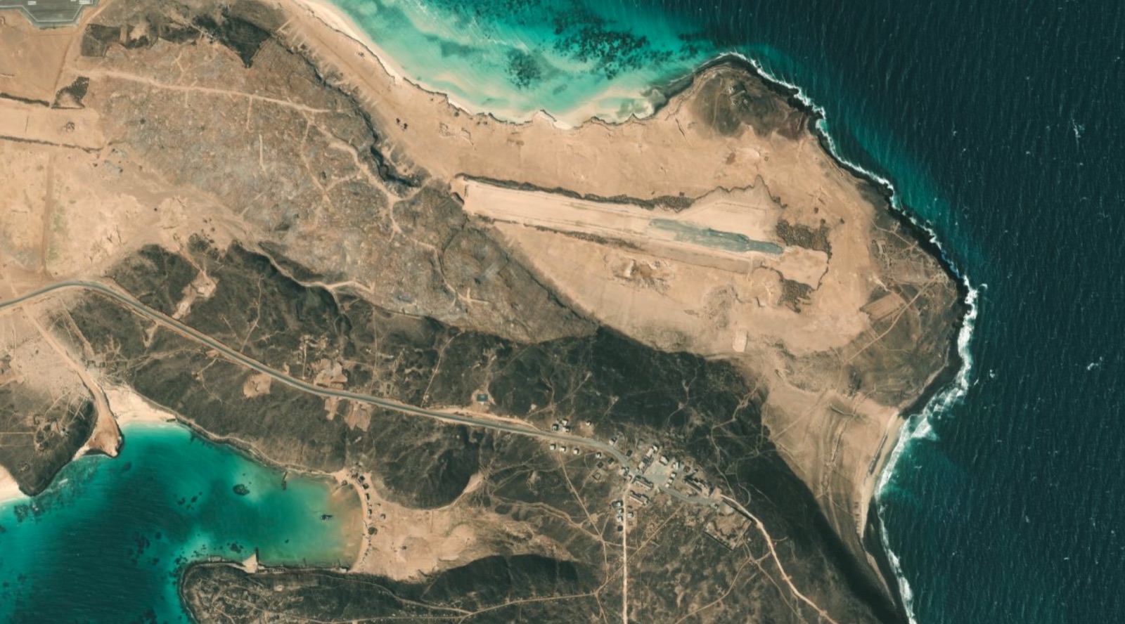 Tap to enlarge
The first attempt came after Emirati forces and their allied Yemeni forces recaptured the island from the Houthis in October 2015.
By late 2016, satellite imagery began to show construction work on an airstrip on the northeastern side of the island. Officials in the Yemeni government said the UAE was building it, but work stopped before the project was completed.
 Tap to enlarge
Years later, another aviation project appeared at a different location in the northwestern part of the island. Satellite imagery from 2021 shows a runway approximately 1.85 kilometers long, along with three hangars.
That same year, the Associated Press quoted Tariq Saleh as acknowledging that his forces, which were backed by the UAE at the time, were present on the island while the runway was being built. His statement documents the presence of those forces during the construction work, but does not, on its own, identify who carried out or financed the project.
The presence of an airstrip within Bab al-Mandab provides forces capable of operating it with air access to the island, allowing them to transport personnel and supplies and support troops stationed there rather than relying solely on maritime transport. A properly equipped aviation facility at this location could also support reconnaissance operations over nearby shipping lanes, although this does not establish that such missions were actually conducted from Mayyun.
The military presence on Mayyun did not remain unchanged throughout the period in which these facilities were built. After Yemeni government forces entered the island in October 2015, Saudi forces were deployed there in July 2019 following the withdrawal of Emirati forces.
In January 2026, reports said that the remaining Emirati military personnel had withdrawn and that forces from the Yemeni Coast Guard and army had taken over the island with Saudi support.
With the Houthis’ capture of Mayyun, their advance extended to a site inside the strait containing aviation infrastructure built during the war, following their seizure of Mokha and Bani al-Hakam airports on the coast. However, control of the island and its runway does not establish that the facility was operational when they arrived or that they had begun using it for aviation activities.
On September 9 and 10, 2026—the same two days on which Khalid bin Al-Walid Camp and then Mokha fell—the Houthi advance along the western coast extended into Al-Khawkhah District in Hodeidah Governorate, nearly nine years after anti-Houthi forces had recaptured it.
Al-Khawkhah contains an older coastal defense camp and another military site south of the city with an unpaved airstrip and a helicopter landing pad, as well as a port used by Emirati forces during their operations along the western coast.
The coalition-backed military presence in Al-Khawkhah began in December 2017, when government forces and their allies recaptured the city from the Houthis. At the time, the Emirati newspaper Al-Ittihad highlighted the role of the coalition and the UAE Armed Forces in supporting the operation. The following year, the UAE used Al-Khawkhah Port as a military base to support its offensive toward the city of Hodeidah.
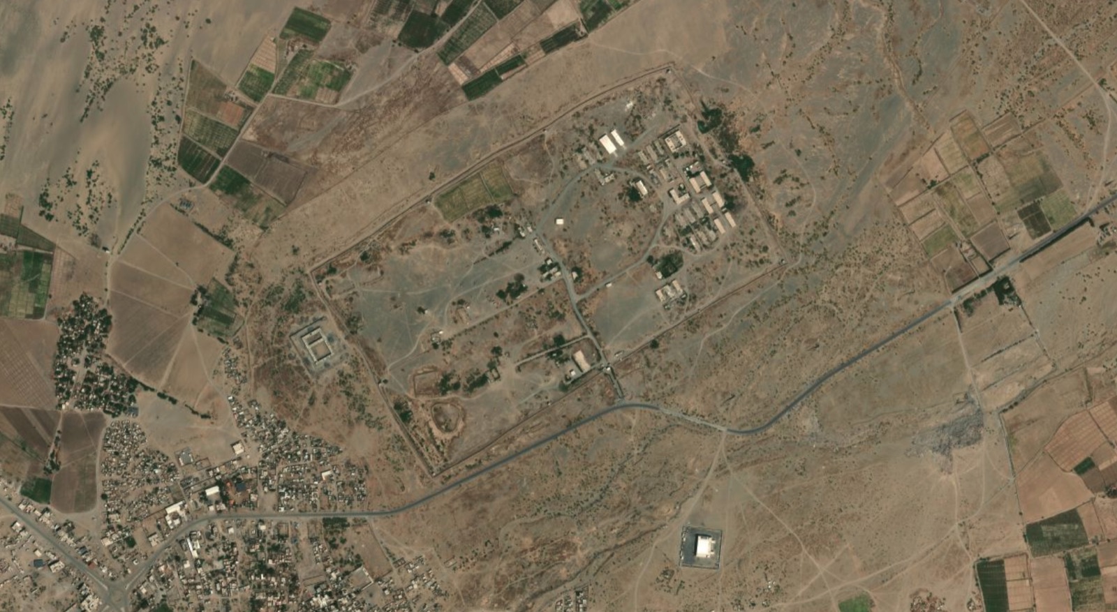
North of Al-Khawkhah lies Abu Musa al-Ash’ari Camp, a Yemeni military facility that existed before the war between the Houthis and coalition-backed Yemeni forces.
After Al-Khawkhah was recaptured in December 2017, control of the camp passed to anti-Houthi forces. By March 2019, the “National Resistance” forces led by Tariq Saleh were in control of it.
The camp’s significance lies in the fact that it was an existing military site that was reintegrated into the deployment network of coalition-backed forces along the western coast.
 Tap to enlarge
Abu Musa al-Ash’ari Camp
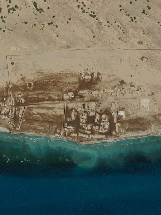
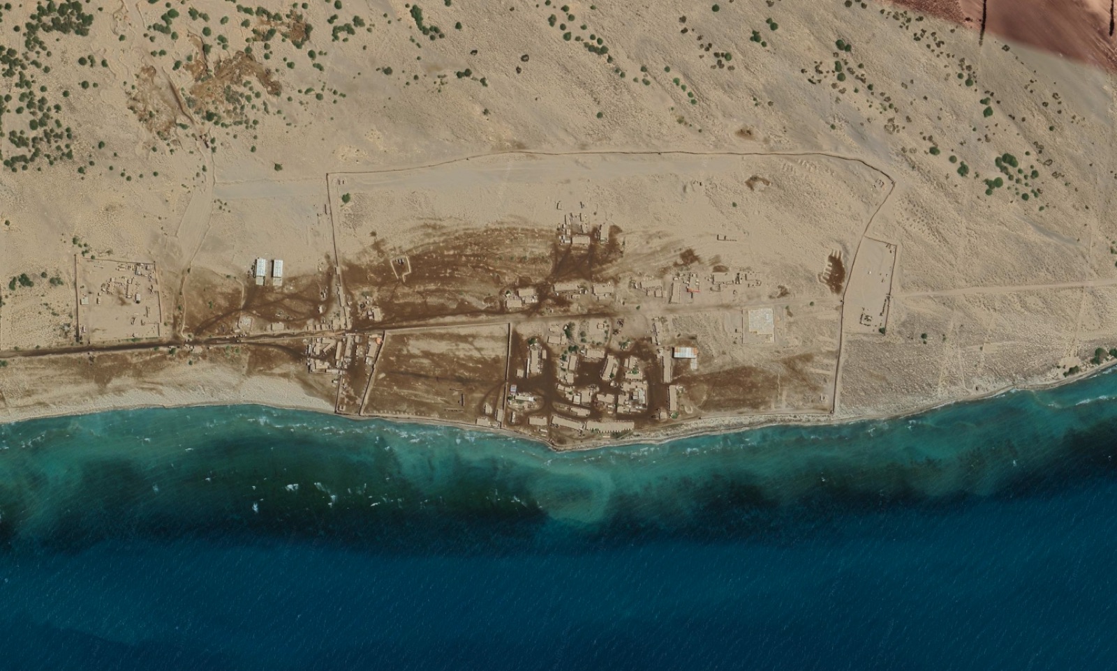
About 8 kilometers south of the city of Al-Khawkhah lies Ambara Camp, which some sources refer to as “Anbara.” Satellite imagery shows that the site comprises a large walled area along the shoreline, containing several buildings and an unpaved runway approximately 900 meters long, as well as a square helicopter landing pad.
The camp served as an operations center for Tariq Saleh’s forces and the Coast Guard until the Houthis seized it during their September 2026 offensive.
 Tap to enlarge
Ambara Camp
Zuqar Island lies in the southern Red Sea, north of the Hanish archipelago, approximately 90 kilometers from the city of Hodeidah. Unlike Mayyun, which lies within the Bab al-Mandab Strait, Zuqar is located to its north, near the shipping lanes extending between the strait and the Port of Hodeidah.
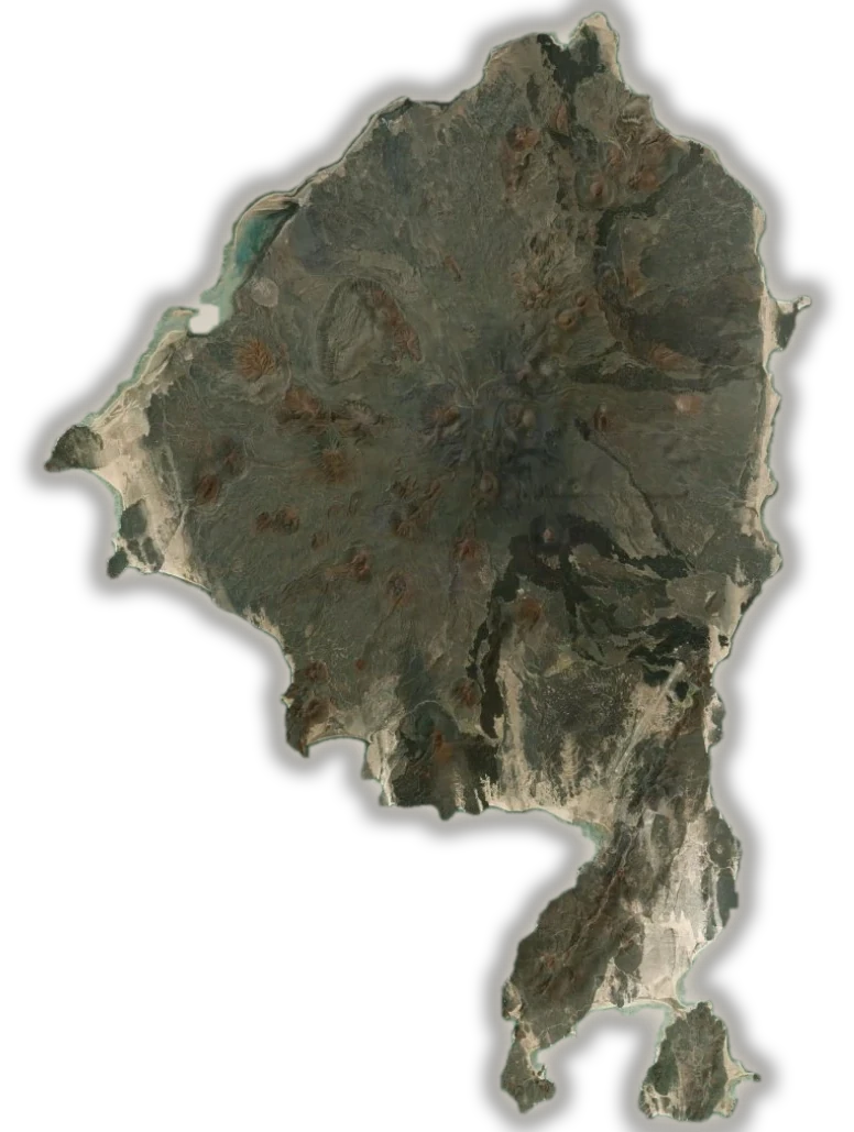
1The airstrip its markings appeared in an image dated 19 October 2025, roughly 2,000 meters long
Control of the island changed hands several times. After the Houthis seized Sana’a in 2014, their forces reached Zuqar. The coalition then recaptured the island in 2015, after which it hosted an Emirati military presence until the Yemeni Coast Guard took control following the withdrawal of UAE forces in October 2019. It later became a base for naval forces loyal to Tariq Saleh.
The most significant change to the island’s infrastructure, however, came in 2025, when construction began on a new maritime pier and airstrip. Satellite imagery, first highlighted by the Associated Press, shows a clear sequence of construction activity.
Construction of the pier began in April 2025, followed by ground leveling along the route of the airstrip. By late August, a layer resembling asphalt had appeared along the strip, while images from September 30 showed progress in paving work. In an image dated October 19, runway markings were visible on its surface, with the Associated Press estimating its length at approximately 2,000 meters.
The simultaneous construction of the pier and airstrip shows that the work carried out in 2025 was not limited to providing an area for aircraft to land. It also gave the island a maritime access point capable of receiving construction materials and supplies, while a new airstrip was being developed in parallel.
Zuqar subsequently remained a deployment site for anti-Houthi forces. In July 2026, the “National Resistance” announced that it had repelled Houthi boats attempting to approach the island. Less than two months later, reports said the Houthis seized it on September 11 during their advance along the western coast and the islands off its shores.
As of the date of publication, fighting between the Houthis and government forces is still under way. And while tracking these sites shows the scale of the shift in the map of control on the western coast, it does not settle how operational the facilities that have passed into Houthi hands are, or how they will be used in the battles to come.
Sites in the order they appear — a filled dot marks a site the narrative has passed